
Wildcat Peak, Tilden Park, Berkeley
I drove to Tilden early. It was cold, one of the themes of the day. About 45 degrees when I got there and never higher than 53 throughout the day. Parked in a main area, even at this early time ( 9ish, I think, I forgot ) a number of families there. This part of Tilden seems to be family friendly. Right next to the parking lot is a playground and not far away is the Tilden little farm.
It was also foggy, another theme of the day. The first 1/2 mile is on a flat paved road with ponds on one side and the hill rising up on the other. The trail heads up into the Eucalyptus forest and chaparral. Not sure if this is actual chaparral, I'll have to look that up. I think this area is supposed to be an Oak forest. So, the much of ground cover is what would be appropriate to oak woodlands but over the years (i.e. logging) the eucalyptus has taken replaced the native oak.
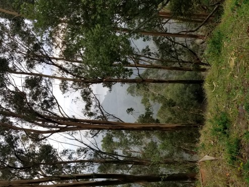
The trail winds up into the hills, I couldn't see much on account of the aforementioned fog. I passed the Peace Grove without knowing I was passing the Peace Grove. After the fact, I read on the Tilden Wikipedia page that it's coastal scrub we're talking about. Anyways, it took about 1/2 hour to get to the top where I could see nothing. Fog. On the peak itself is a big round rock structure with a view point for the Peace Grove, which I couldn't see. If there's no fog the views are GREAT!
I circled the peak area and headed back down. There were a lot of bunnies around. I didn't get a picture.

The misty trail to the top.

The views form the peak.
Grizzly Peak
Grizzly is sort of easy to get to. It's just off the road, up a short but steep non-trail. I'm not sure about the legality of getting up there. The actual top is a fenced in communication facility. There were parking spots almost directly across the street from the 'trailhead', but all the close convenient ones are blocked off, and I had to park about 1/3 of a mile away and walk on the side of the road to get to back to the trailhead.
There's something on Google maps called "Grizzly Peak Actually".
The short trail to get to the peak (it's only about 100 yards) is actually a trailhead for a trail that heads in a different direction.
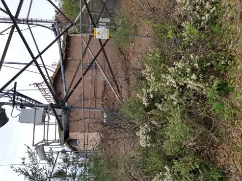
Grizzly Peak.
The views from the fenceline.
Volmer Peak
The Vollmer peak trailhead is was only about 1/3 mile drive from my roadside grizzly Peak parking. The trail starts on an easy flat trail, the Vollmer Peak trail ( according to Google maps ), after a short ways take a sharp right on the Lupine Trail which dead ends after a couple hundred feet into the Vollmer Peak Road. The rest of the way is a steep old paved access road to the top where you'll find, you guessed it, radio towers. From the top you can see Grizzly peak where I just came from.
So who's Vollmer?
On the way back I saw on Google maps a Vollmer Peak trail ( there seem to be several of these ), which looked to be more direct. It started off fine, looking like an unused access road. I passed an area where there had been some tree removal in the recent past. It took a turn downhill into the bushes and got worse and worse. Obviously not a maintained trail and I have to do some minor bushwacking. I may have missed a turn but regardless that was an unofficial trail, to paraphrase Monty Python; This trail has passed on, it is deceased, the trail is no more.
I got back to the car after about a 1/2 hour and a solid mile of checking that peak box.
I still want to know who Vollmer is though.
Ah! It was named after August Vollmer ( b. 1876 - d. 1955 ) who was the first police chief of Berkeley and is known as "the father of modern policing".
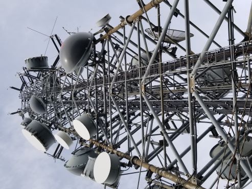
Radio Towers on Volmer Peak.
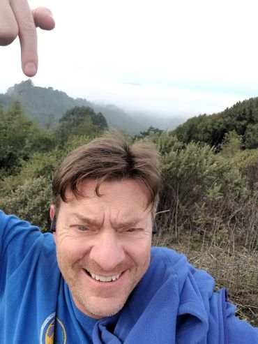
Pointing to Grizzly Peak. Mt Tam is in the same picture.
Round Top
Round Top in Robert Sibley Volcanic Regional Preserve was the only failure of the day. Not sure how accessible it is anyways, but the main road towards the summit was blocked by tree work. Eucalyptus removal I think. Aside from the radio tower tops throughout the day, I did get a new appreciation for the Berkeley/Oakland hills and the parks within. I'd like to spend more time in some of them. But Sibley was the most intriguing. Round Top itself is an old volcano and the park has a bunch of volcanic learning.
I went up the road to a water tower on the West side of the hill. This is the first spot on the self-guided volcanism tour of the park. There is a use trail starting at the back of the water tower and going up. I went up that until it petered out. Probably could have pushed on and make it to the top but didn't want to be aggressively off-trail in such a busy park. I could see the tree workers most of the way and there was a Oakland police vehicle sitting in the parking lot.
The GPS tracks that are published on Peakbagger show most people summiting via the access road; the one that was blocked by tree cutting.
Redwood Peak
Redwood Peak is in Roberts Regional Recreation area, really. From Sibley to Roberts is a nice drive along Skyline. The parking lot for the hike is just past the Chabot Space Center. It's interesting the change in flora from coastal scrub ( and invasive eucalyptus ) to redwood forest. Roberts is beautiful. Giant redwoods. Lush and cool. These are actually 2nd growth redwoods, the original grove was cut down sometime in the 1840s to 1860s. The original grove would have been something to see. There were two trees so large that they were used as a navigational aid for ships on the bay. They no longer exist but there's a plaque.
The hike is short ( as they all are for this day ) but really nice to walk amongst the big trees. The peak itself is a jumble of rocks surrounded by big trees.
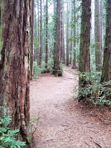
The trail to Redwood Peak.
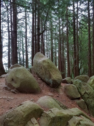
The peak itself.


